
A PhD student, scrolling through publicly available survey material from a Mexican environmental project, noticed shapes that didn’t sit comfortably with the idea of untouched jungle. The files had been online for years; nothing new about them. But once processed through archaeological mapping techniques, the patterns stopped looking like random terrain. Roads, raised platforms, and something that resembled a planned settlement rather than scattered earthwork. What followed wasn’t a dramatic expedition into unknown territory, more a quiet reassessment of information already sitting in plain sight. A place later named Valeriana began to take shape on screen before anyone set foot there with fresh intent.
Lidar data reveals what the jungle hides from the eye
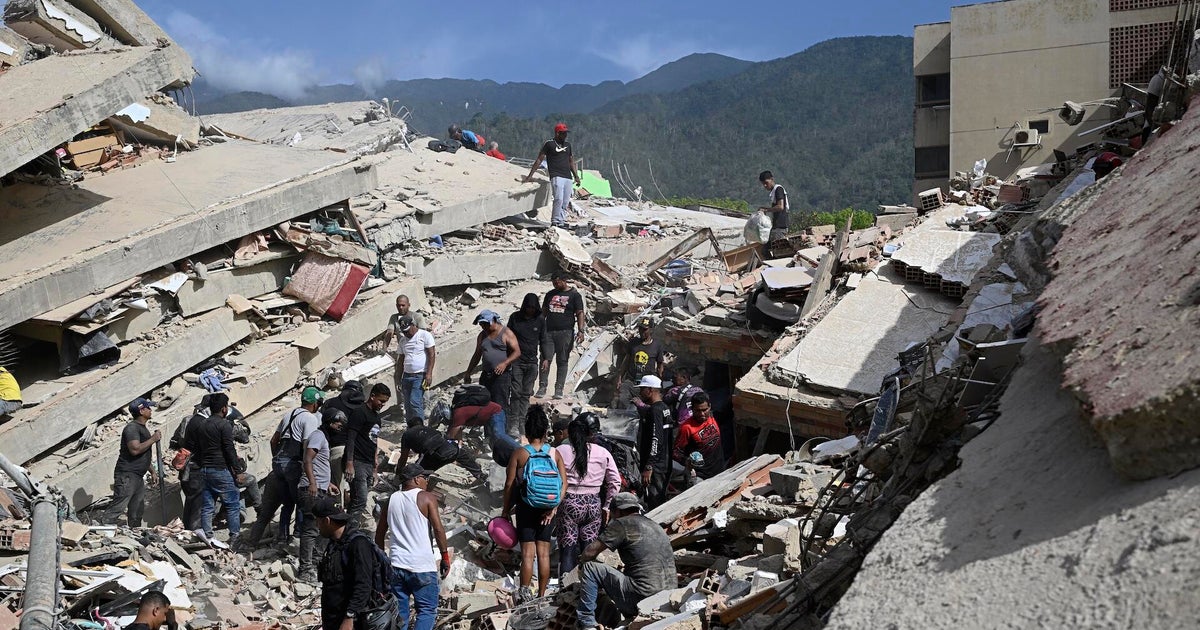
The discovery didn’t come from trekking deeper into dense forest or brushing vines away from stonework. According to the study published by Cambridge University, titled ‘Running out of empty space: environmental lidar and the crowded ancient landscape of Campeche, Mexico’, reveals that it came from airborne laser scans, the kind used to strip away vegetation digitally. Lidar, as it is known, fires rapid pulses towards the ground and measures what bounces back, producing a bare-earth map beneath the canopy.In this case, the scan had been done for environmental monitoring. It wasn’t labelled as anything archaeological. That detail mattered. Without that mismatch, the outlines of an ancient urban layout might have stayed unnoticed. When the data was reprocessed, a pattern emerged that looked too deliberate to ignore. Blocks of structures, linked spaces, what appeared to be roadways cutting through sections of forest floor that had long since reclaimed them.The area covered a stretch of southeastern Mexico in Campeche, not far from modern roads and settlements. The irony wasn’t lost on the researchers later. A place large enough to once hold tens of thousands of people had been sitting within a short walk of everyday traffic.
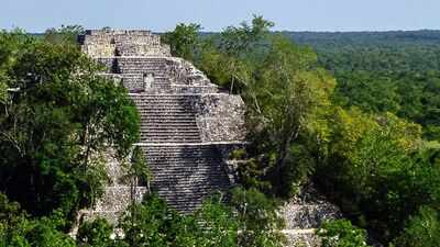
A forgotten city revealed in layers of forest and time
What the scans revealed was not a single ruin but a cluster of organised spaces. Two main centres stood out, separated by a couple of kilometres, with dense residential clusters and connecting causeways between them. The impression was of something planned rather than accidental growth.There were stepped structures consistent with temple platforms, open plazas that would have allowed gatherings, and a ball court shaped for a game that carried both ritual and social weight in Maya life. The layout suggested a settlement that had layers of public, ceremonial and domestic space, rather than isolated clusters of dwellings.As reported by The BBC, the site spans roughly 16 square kilometres, though that figure barely captures what it means on the ground. From above, it reads more like a stitched patchwork of human activity frozen beneath forest regrowth. Some estimates suggest a population that could have reached several tens of thousands during its peak centuries ago, though such numbers remain tentative.
How modern scans reveal hidden patterns beneath dense jungle canopy
For a long time, parts of the tropical Americas were described in old academic writing as thinly populated or even marginal for complex civilisation. That idea has been steadily eroded as lidar surveys expand across the region.Valeriana adds weight to a different interpretation. Rather than scattered villages separated by wilderness, the landscape appears more continuous, filled with interconnected settlements. The jungle, in this sense, is less an untouched backdrop and more a later layer covering what was once an inhabited world.A professor involved in the research described the terrain as having been settled in a way that is not obvious to the eye today. What looks like empty forest from ground level becomes something more structured when seen from above, as if the land still remembers its former organisation even after centuries of overgrowth.
Environmental stress and uncertain causes behind the abandonment of Valeriana
There is no single agreed explanation for why places like Valeriana were abandoned. The most cautious readings avoid neat conclusions. Still, environmental pressure sits near the centre of many discussions about the wider Maya collapse during the late first millennium.Periods of drought likely placed stress on water storage and agricultural systems already working at capacity. Reservoirs identified in similar sites point to careful management of seasonal rainfall, suggesting communities were adapting to unpredictable conditions rather than simply exploiting abundant resources.When populations are dense and resources tightly balanced, even modest shifts in rainfall can ripple through food supply, settlement stability and political structures. That is one line of thinking, at least. Warfare and later disruption linked to Spanish arrival in the 16th century added further layers of abandonment and change, though those events came after many urban centres had already declined.Valeriana itself sits within that wider historical uncertainty. Its final years remain unreadable from the surface traces alone.
The accident of modern discovery
What makes the story slightly unusual is not just the city, but the route by which it came back into view. The dataset that revealed it had been sitting in public access, generated for environmental purposes rather than archaeology. It was only when someone working outside its original framing examined it closely that its significance shifted.The researcher later described finding it almost by chance, buried deep in search results rather than hidden in the jungle. That detail has stuck, partly because it reshapes the idea of discovery itself. In this case, nothing new was created. The information already existed. What changed was the lens.From there, multiple sites began to emerge across the same survey region. The broader picture hinted at a much denser occupation than previously mapped, with thousands of structures appearing once vegetation was digitally stripped away.